For Neil Anderson, and the rest of the ProNav team, “We Drive. You Fish.” is personal, speaking to our commitment to anglers to provide total boat control made simple and easy.
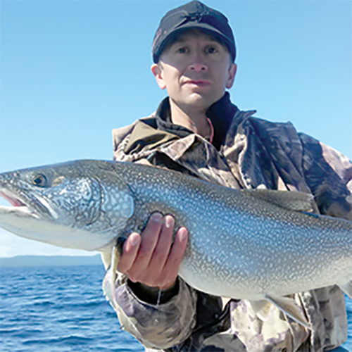
Neil, Co-Founder of ProNav Marine, is an avid outdoorsman. He has enjoyed a successful career in manufacturing and engineering, and working on the ProNav Angler has afforded the opportunity to merge this technical background with a passion for fishing and boating. Neil has worked hard to help create a robust and easy-to-use autopilot system, and he has found it to be an extremely beneficial tool to use while fishing for steelhead, salmon, lake trout, and smallmouth bass on his home waters in the Upper Peninsula of Michigan.
When asked which features of the ProNav Angler he likes best, Neil said, “I love the Navionics route import feature,” adding that, “the Navionics boating app is a great bargain–for just $9.99 [annual subscription], you get all of their lake maps for the United States.” These Navionics lake maps offer one foot depth contour lines for bodies of water small and large and are equivalent to the chips that you would use in a fishfinder / chartplotter, which typically retail for $100-$200 each. Instead, Navionics maps can be loaded directly onto your phone or tablet (HD tablet optimized subscriptions are available), making this price a great value. Map data can be “cached” (saved) to your device over Wi-Fi while at home to be used on the water, not requiring you to use your mobile data. Saving map areas on your mobile device is also beneficial for those who fish in remote “off-the-grid” areas where mobile data is not available. The ProNav Angler GPS autopilot system does not require a data connection to function and simply relies on a Bluetooth signal between the ProNav GPS unit and the mobile device used to control the motor.
Neil uses the Navionics “fishing mode” (found under map options in the mobile app) to target a specific depth range. This mode highlights the desired depth range on the lake contour map, making it extremely easy to create points along the highlighted region and to identify similar structure areas to those that are producing fish. After exporting Navionics routes and waypoints to the ProNav mobile application, your motor can be programmed in seconds to provide endless hours of hands-free fishing. Neil explained that, “ProNav automatically controls the motor, guiding you on your preprogrammed routes, while you are busy fishing.”
“Importing routes from the Navionics boating app into the ProNav Angler app is easy and is an awesome way to free up a person in the boat that would otherwise have the chore of driving,” said Neil. Together, ProNav and Navionics can be utilized to steer the boat in the desired direction, at a specific speed, and over specific depths. These mobile apps make it easy to locate structures and keep your boat on top of them while you fish. For Neil, this is particularly useful when fishing for Coho salmon and lake trout around the Keweenaw Peninsula on Lake Superior. Neil has found that, “Locating reefs, drop-offs, and irregular bottom structures is essential, and running spoons along these structures is critical to success—on big water such as Lake Superior, finding fish can be like searching for a needle in a haystack, and precise boat control makes all the difference.”
If your fishing goals for this season include spending more time fishing and catching more fish, click here to learn more about the ProNav Angler or purchase yours online.
